Combining in situ and satellite measurements in oceanography
PHIDIAS and the contribution of the University of Liège
To process large volumes of data High-Performance Computing (HPC) is essential. A European project like PHIDIAS will focus on spatial and environmental data spanning the earth’s surface, the atmosphere and the oceans to develop and offer a catalogue that will allow users to discover and access data, but also relevant open source software, public APIs and also interactive processing services. This catalogue will implement interoperable services for the discovery, access and processing of the data, and be connected to other major data repositories. PHIDIAS will also implement an end-user web common interactive processing service based on notebook and data cube technologies.
Among the 13 competent PHIDIAS partners is the University of Liège, which will bring its expertise in terms of spatio-temporal interpolation techniques applied to oceanographic data, which has already been shown by the development of the DIVAnd software tool that was designed to interpolate in an arbitrary number of dimensions (longitude, latitude, depth and time) a large number of in situ observations, for instance profiles and time series of temperature, salinity, or oxygen concentration. In addition, they are developing other interpolation techniques based on neural network, particularly useful when applied to variables where the number of measurements is very limited, for instance the zooplankton concentration.
Combining in situ and satellite measurements in oceanography
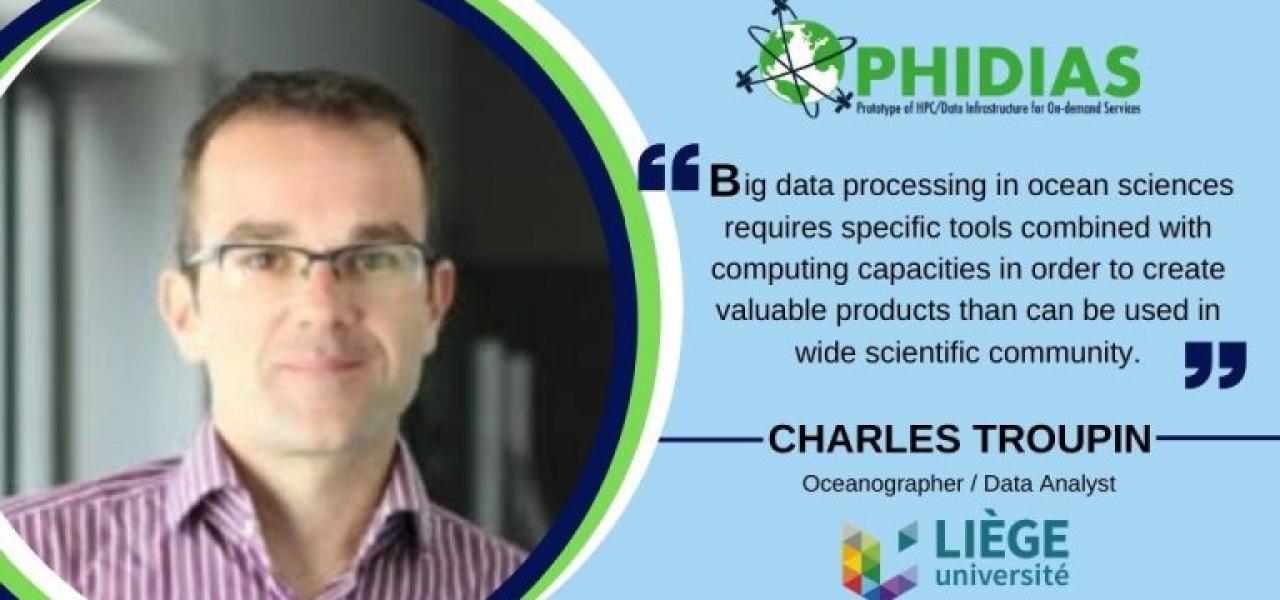
Charles Troupin, researcher at the University of Liège, explained us that PHIDIAS can be helpful to apply the interpolation techniques that they are developing to very large datasets and to speed up the data reading and writing processes. The use of HPC will also make it possible to run interpolation applications on large spatial domains.
The University of Liège will be particularly involved in the Marine Data Processing Workflow. Charles Troupin highlighted that “one of the specificities in oceanography with respect to other domains is the scarcity of data”: measurements are dominantly acquired close to the coast and when the conditions at sea are good enough, while satellite measurements provide better spatial and temporal coverages but are limited to the surface layer of the ocean and are also affected by clouds, which lead to gaps in images. For this reason, the challenge that PHIDIAS is trying to overcome is to use different types of measurements, in situ and satellite, to construct gridded field of selected variables.
As Charles Troupin reminds, “big data processing in ocean sciences requires specific tools combined with computing capacities in order to create valuable products than can be used in wide scientific community”.